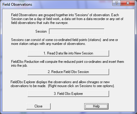
Field Observations
The Field Obs Explorer allows the user to enter, change and reduce field observations.
Field Observation Explorer - New Features
- New data entry method no booking methods
- Tree view of the observations, setups and sessions
- Plan view of observations diagram
- No external field observation data file
- All field observation data is stored in the acs file
- New reduction method and listing of field data
- Allows reductions of observations with or without heights in any order
- Allows easier method of setting station setup azimuth swing
- Optionally stores user defined point numbers
New data entry method - no booking methods
The observation data is entered in two formats, 'Slope Distance' format or 'HV Differences' format. These records can be intermixed in any order, each observation will be reduced using the data provided.
For a Slope Distance observation you should provide:
Data field XYZ shot XY shot
Slope Distance Reqd Reqd
[Height of Target] Reqd
[Vertical Angle] Reqd
Bearing Reqd Reqd
Code
Point number
Observed station
Remark
For a HV Differences observation you should provide:
Data field XYZ shot XY shot
Horizontal Distance Reqd Reqd
Vertical Distance Reqd
[Height of Target] Reqd
Bearing Reqd Reqd
Code
Point number
Observed station
Remark
Tree view of the Field Data
All the field observation data is stored in a 'Tree' view object in the Windows application. A collection of field information is called a 'Session', which probably would hold a day of field work. You can name the session 'Day1', 'Day2' etc as you wish.
Each Session can contain any number of Observations, Stations Setups and Point definitions. The tree view displays observations underneath the station setup.
Plan view of observations diagram
When the data has been reduced the application can display a plan view of the observations on the job. This draws a line from the station to the observed point representing each observation with a line. In addition, there is a 'Highlight' option on the Context menu of the Station Setup on the Explorer to highlight the observations for that station setup.
The observations display is assigned to a layer 'Field Obs' can be turned on or off or changed in colour by changing the layer. To assign the Field Obs to a particular layer, use the Properties option on the 'Sessions' tree entry.
No external field observation data file
The observation data can be read in directly from the raw data recorder file into the job. All field observation data is stored viewed and edited in the job. When data would have been stored in a .sta file, it can now be read into the job as a Session. Thus the .sta files can be discarded.
When the job is saved, the field observation data is saved in the .acs job file.
Import Field Data Direct from Data Recorder File
Right click on the Sessions entry or on a session with no data and select the option 'Read Field Data File'. This option, allows the data recorder file information to be imported directly into a Session. If you don't have a session, one is automatically created.
The following Data recorder formats are supported.
- GeoSurvey .sta file
- Sokkia SDR2/3/33 format
- Leica TPS1100/1200 gsi format
- TDS/RW5 format
- Neutral file format
New reduction method and listing of field data
To reduce a Session, select the session in the Explorer, right click the mouse and select the 'Reduce Session' option. This is a new reduction function which will reduce the session observations directly into the job and will produce a listing of the reduction if required. It will optionally reduce into a specified range of points and will also optionally perform string coding (form code strings and point symbolisation) and code checking.
The listing layout has also been changed to simplify the layout. It allows for fixed columns for the observation readings and a variable area on the right to accommodate data which may or may not be present such as code, observed station and remark.
Mimaka Pty Limited            Field Obs Reduction                         Page:1
GeoSurvey V6.45                      a.acs                           01-Sep-2005

================================================================================
PT       DIST  HT-TGT  VERT-ANG    HOR-ANG      EASTING    NORTHING   HEIGHT COD
================================================================================

1        S111                                366821.896 1363147.042    0.702 Cd='SN'
2        S113                                367383.638 1362555.319    2.484 Cd='SN'
3        S112                                366568.620 1362547.997    1.521 Cd='SN'
4        S120                                367013.981 1362732.699    2.484 Cd='SN'
5        S115                                367536.211 1363318.661    1.063 Cd='SN'

3       Setup Stn S112          HtIns=1.650  366568.620 1362547.997    1.521 Az Swing   0°00'00"
       482.142  1.320  89°55'56"  67°28'30"  367013.980 1362732.699    2.421 Cd='SN' Obs=S120
                                      Diffs       0.001       0.000    0.063 Check obs to S120

4       Setup Stn S120          HtIns=1.337  367013.981 1362732.699    2.484 Az Swing   0°00'00"
       482.142  1.850  90°03'44" 247°28'30"  366568.621 1362547.997    1.447 Cd='SN' Obs=S112
                                      Diffs      -0.001      -0.000    0.074 Check obs to S112
       410.005  1.460  89°59'55" 115°38'04"  367383.630 1362555.319    2.371 Cd='SN' Obs=S113
*** Check ray failed                  Diffs       0.008      -0.000    0.113 Check obs to S113
       482.142  1.610  90°05'30" 247°28'30"  366568.621 1362547.997    1.440 Cd='SN' Obs=S112 Rm='Check Shot'
                                      Diffs      -0.001      -0.000    0.081 Check obs to S112
       482.142  1.610  90°05'30" 247°28'30"  366568.621 1362547.997    1.440 Cd='SN+X3' Obs=S112 Rm='Check Shot'
                                      Diffs      -0.001      -0.000    0.081 Check obs to S112
6       15.848  2.850  87°08'30" 318°27'30"  367003.484 1362744.546    1.761 Cd='RD'
7       32.356  2.850  88°27'53" 307°19'45"  366988.262 1362752.312    1.838 Cd='RD'
8       49.683  2.850  88°49'48" 304°20'14"  366972.965 1362760.717    1.985 Cd='RD'
9       67.903  2.850  89°14'46" 301°24'38"  366956.034 1362768.085    1.864 Cd='RD'
10      63.377  2.850  90°00'14" 317°37'35"  366971.267 1362779.520    0.967
11      50.101  2.850  90°02'25" 331°50'28"  366990.337 1362776.870    0.936
12      39.475  2.850  89°29'16"   8°19'41"  367019.698 1362771.756    1.324
13      41.055  2.850  90°15'22"  11°51'18"  367022.415 1362772.878    0.787 Cd='Hole' Rm='Dip in the bank'
14      41.345  2.850  89°58'12"  17°43'34"  367026.569 1362772.081    0.993
15      47.065  2.850  89°31'07"  37°57'48"  367042.932 1362769.804    1.366
16      73.149  2.850  89°47'45"  60°46'06"  367077.814 1362768.421    1.232
Allows easier methods of setting station setup azimuth swing
There are three ways to set the Azimuth Swing for a station setup.
1. On the station setup, enter the desired Azimuth Swing. If this value is entered, it will always be used.
2. If this Station setup Azimuth swing value is blank, the reduction will attempt to establish the Azimuth swing by looking at the first observation from the station, and if it is to an 'Observed Station', for which it already has co-ordinates, it can compute the Azimuth swing.
3. The first observation to an 'observed station' may consist of a horizontal bearing value only. This is enough information to compute the Azimuth Swing for the station setup. This observation will not be used as a standard observation if it does not have enough data to compute the target point.
Optionally stores user defined point numbers
On each observation, the user can optionally enter a point number. If this specified, the reduction will always use that point number for the observation. If the point number is not supplied, it is blank, the reduction will automatically assign the next available point number in the range of points assigned for that Session.
When data is read from the data recorder, there is an option to 'Use data Recorder Point Numbers' in this case, the point numbers from the data recorder will be copied into the 'Point Number' field on each observation and will be honoured during the reduction.
Using Field Obs Explorer
It is available on the Topo/Field Obs Explorer menu option.
It is also available on the Topo toolbar, 4th button from the right.
Note that the Field Obs Explorer is 'modal', that means that you cannot perform any actions on the main screen or the main menus without closing the Explorer.
Most of the items in the tree have a Context menu (right click the mouse on the item) to allow functions to be performed on that items. For example to delete an observation, right click on the observation and select 'Delete'. You can also change (Properties) on all items by double clicking on the item.
Code Translation
Before a reduction is done, if the 'Form Strings' option is selected, the codes will be translated if required. For information on Code Translation click here.